Welcome to Quancons Forensic Indonesia
We are your trusted partner for innovative solutions in survey, mapping, spatial planning, and civil consultancy. With cutting-edge technology and a dedicated team of experts, we deliver precise, sustainable, and efficient services tailored to your unique project needs. Tagline: "Innovative Solutions in Survey, Mapping, Spatial Planning, & Civil Consultancy."
Our Brand Story
Quancons Forensik Indonesia is a multidisciplinary consultancy and technical service provider specializing in transportation, industrial management, engineering solutions, and geospatial technologies since 2023.
Established with a vision to deliver excellence, we are committed to offering tailored solutions that meet the unique needs of our clients across various sectors.
Our core competencies span across transportation consultancy, industrial management advisory, architectural and engineering consultancy, and geospatial mapping services. With a robust team of experts and cutting edge technologies, we ensure precision, innovation, and sustainability in every project we undertake.
"Excellence and Collaboration" To produce the best works and establish collaboration as the leading partner in the fields of surveying, mapping, and spatial planning.
- Actively collaborate with all partners to deliver outstanding results.
- Provide optimal solutions to partners in addressing various challenges.
- Uphold ethics and professionalism in all aspects of work.
- Enhance the capabilities and capacities of human resources and technology to compete on both national and global scales.
- Build strategic partnerships and synergize with clients and partners based on principles of mutual benefit.
Services
OUR SERVICES
TOPOGRAPHIC SURVEY
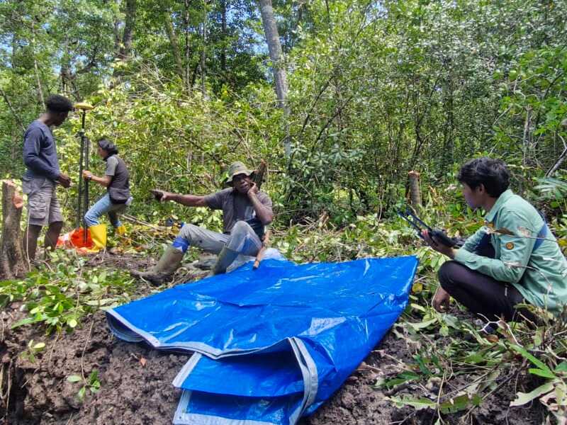
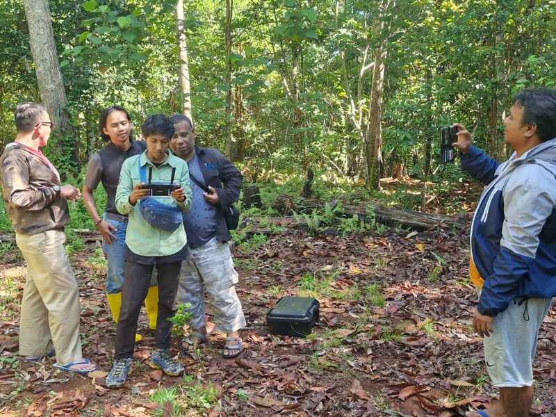
Topographic surveys utilize advanced measurement techniques to determine the relative position and elevation of natural or man-made features on the earth’s surface. This information is critical for evaluating environmental impact, designing infrastructure, and ensuring accurate construction planning. We provide topographic survey services for various sectors, including: - Industrial, Oil, Gas, and Aviation sectors - Roads and Highways - Railways (Routes & Bridges) - Wastewater and Water Management - Irrigation Systems – Dams & Canals - Power Lines - Engineering/Architecture (Design & Planning) - Digital Mapping (GIS & Data Analysis) All surveys are conducted by highly skilled personnel and supported by state-of-the-art equipment to ensure quality results. Our commitment to customer satisfaction includes adherence to safety and environmental standards.
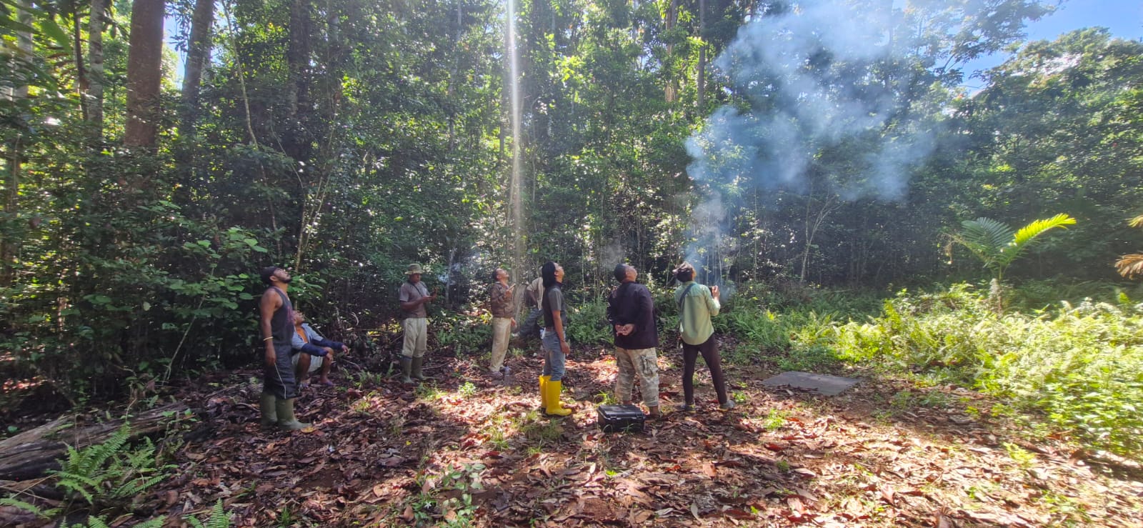
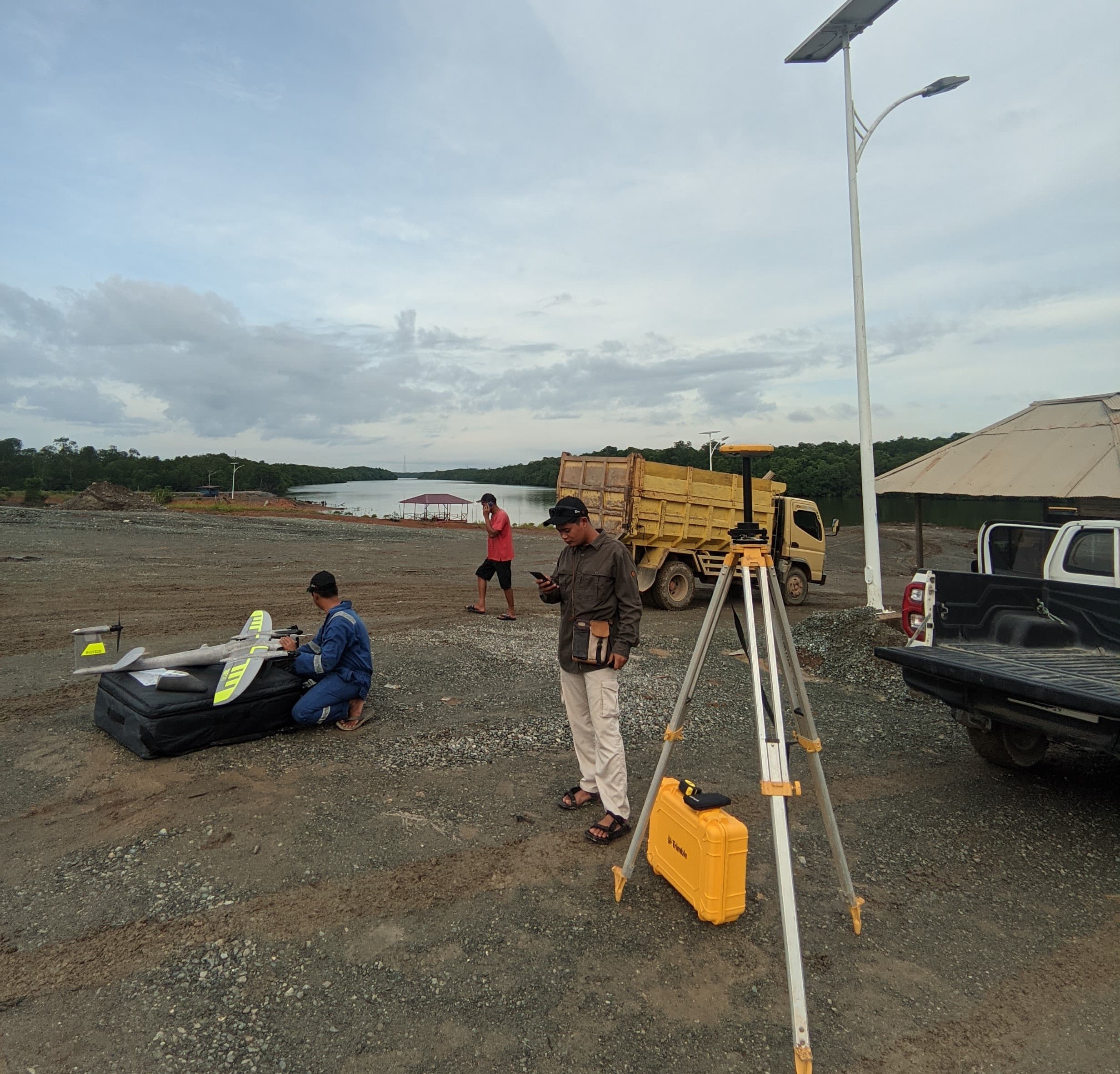
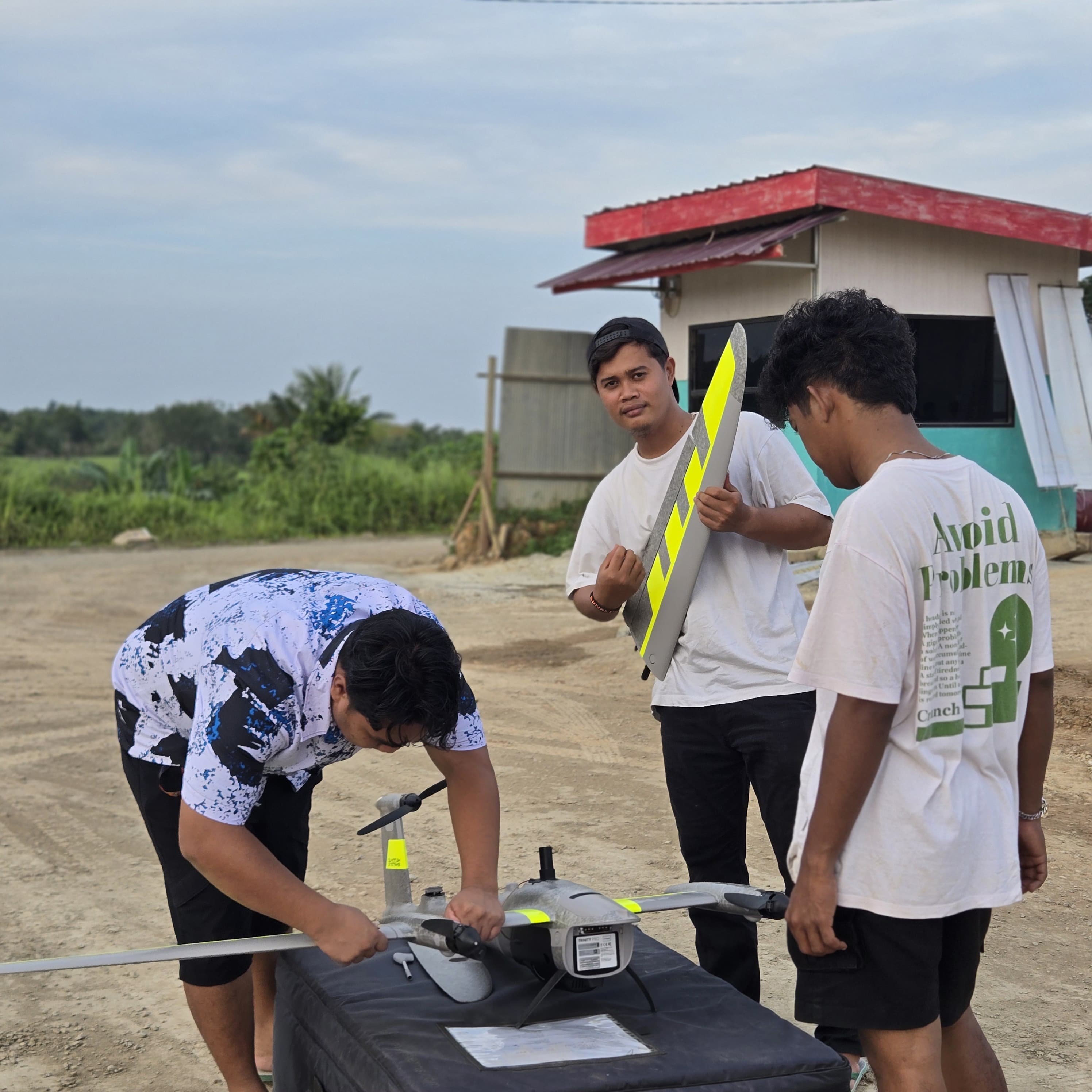
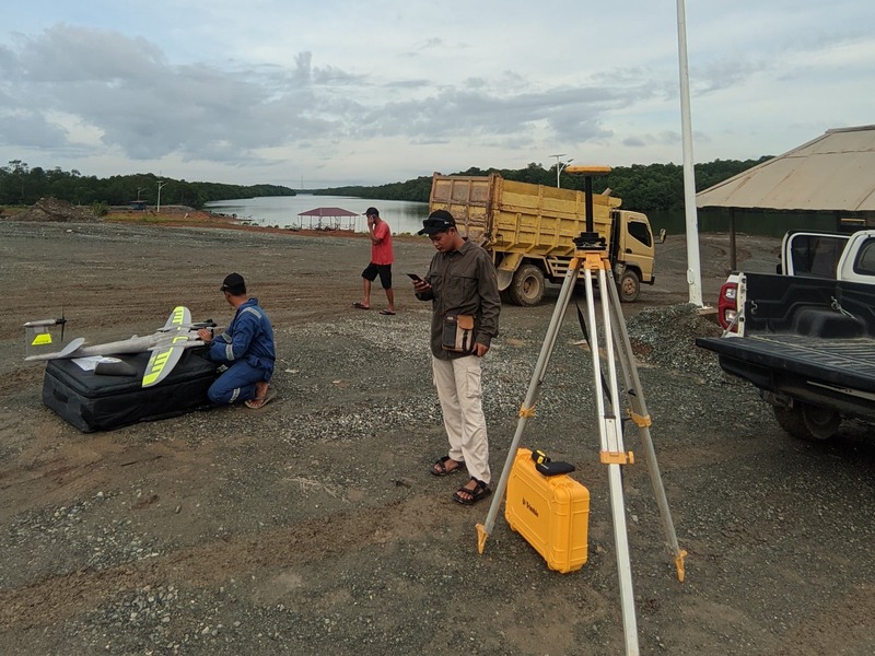
AERIAL MAPPING (PHOTOGRAMMETRY)
Aerial mapping employs photogrammetry techniques using high-resolution UAV/drone imagery to produce detailed visual data. This method is effective for monitoring project progress, inventorying field conditions, and planning for industrial and commercial development. Key services include: - Forestry Mapping - Industrial Plantation Mapping - Residential Area Mapping (Excluding Airports) - Mining Site Mapping - Lidar Mapping Our aerial mapping solutions ensure precise and reliable data, delivered by experienced teams with advanced tools to meet safety and quality standards.
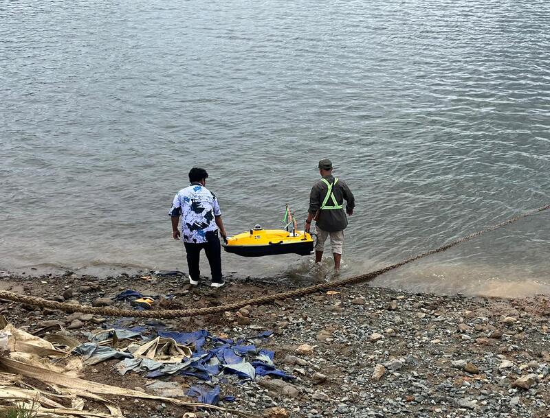
BATHYMETRIC OR HYDROGRAPHIC SURVEY
Bathymetric surveys focus on underwater terrain mapping to assess seabed, riverbed, and lakebed conditions. This process generates critical data for ensuring safe and efficient maritime transportation. Deliverables include: - Bathymetric Data Reports - Contour Maps of Seabed - 3D Models - Scaled PDF Maps (Printable) - GIS and DWG Data All projects are performed by trained professionals using modern equipment to ensure accuracy, safety, and compliance with applicable standards.
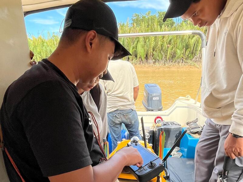
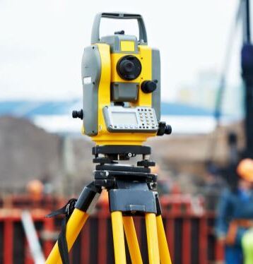
GPS/GNSS SURVEY
Our GPS/Geodetic survey services ensure high-precision location and elevation data essential for project planning and implementation. Applications include: - Detailed Site and Topographic Measurements - Volume Determination for Areas/Regions - Benchmark and Ground Control Point (GCP) Positioning - Data Collection for Mining Business Permits (IUP) Equipped with advanced GNSS technology, we guarantee reliable results tailored to meet specific project requirements, from construction to utility planning.
CIVIL CONSULTANT
We provides expert guidance in structural design, feasibility studies, regulatory compliance, construction supervision, and risk assessment to ensure safe, efficient, and sustainable construction projects.
Portfolio
OUR Portofolio
PT Digiplan: Benchmark GNSS Survey for IKN – PSSI Segment
Objective: Establish accurate benchmark reference points for road construction.
Outcome: Completion of BM IKN 22, BM1, and BM4 benchmarks, ensuring precision in construction work.
PT Pupuk Kaltim: Aerial Mapping for Fakfak, West Papua
Scope: Documentation of a 250-hectare area for spatial planning. Outcome: Generated 729 high-resolution images and a Digital Elevation Model (DEM).
PT Westitan/Adhi-Naviri-Surya Bakti, KSO : Bathymetric Survey for Pulau Balang Bridge Area
Objective: Map the seabed topography for the bridge duplication project. Outcome: Provided accurate bathymetric data for risk mitigation.
PT Nindya Beton: Stock Opname Survey
Scope: Measurement of material volumes within the project area. Outcome: Determined material volumes of 2,870.35 m3 and 1,456.79 m3 for different materials.
Inventory Catalogue
New Products Year 2025
Professional Tools Supporting Quality Work
Quancons Forensik Indonesia is committed to delivering reliable services supported by professional-grade tools and equipment. This catalog provides an overview of the essential instruments we use in our daily operations, including survey devices, mapping technologies, and engineering inspection tools, ensuring precision and trust in every project we handle.
To download the full version of the Quancons Forensic Indonesia Inventory Catalogue, please click the button below.
Contact
Connect with us
Address
Kabupaten Penajam Paser Utara, Kalimantan Timur
Call Us
+62 851 666 7777 0
Email Us
info@quanconsforensikindonesia.com